Venta river route download for mobile devices (android/iphone)
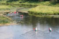
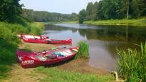
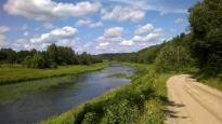
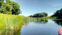
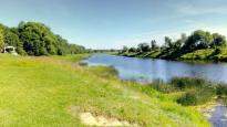
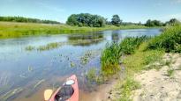
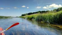
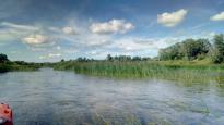
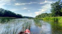
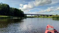
The Venta is suitable for paddling with kayaks, canoes and rafts. Along the riverbanks you will find camping and resting areas - private and public.
The most popular paddling section in Venta is from Vadakste estuary by the Latvian Lithuanian border or from Nīgrande till Skrunda, these will be routes for 2 days canoeing.
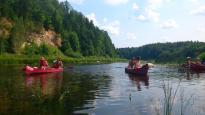
In Nīgrande (B) - the most nicest section of Venta starts. The next 13,2km till the Letiza estuary is a string of islets, fords and quick-streams. Behind the outlet of the Skervelis (C) the Venta still flows quite rapidly and beautiful forests appear on the banks. After a wide curve the Venta carves into a dolomite detrition about 13m in height. These are the Gobdzini rocks. Here is an overflow in the river; the place is beautiful and it is definitely worth stopping and climbing the rocks to view the landscape.
Behind Gobdzini rocks thee forest withdraws from the river, it throws a few large arcs until paddlers spot the church towers of Leni Catholic church. Right at the foot of the Church is a good place to finish paddling. The next 8.8 km to Skrunda the Venta flows through farmed fields. There is nothing special to see here - everything depends on your companions and the motivation to reach Skrunda (D) - another possible finish station for paddling.
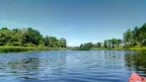
After the Vadakste river estuary (A) for 3km the Venta forms the Latvian - Lithuanian border. Around 30m wide, a shallow stream with a good fall; during the summer at places it is overgrown with water-weeds, with beautifully grown in trees here and there along the banks. The first islets appear in the river, although their numbers are reducing. Both sides of the river are farmland; frequent shrubs grow along the river.
600 m behind the Losis the tributary of the right bank – the Zana - is located, and after less than 2km Nigrande appears (B), and this is where the nicest section of Venta starts. The next 13,2km till the Letiza estuary is a string of islets, fords and quick-streams. Behind the outlet of the Skervelis (C) the Venta still flows quite rapidly and beautiful forests appear on the banks. After a wide curve the Venta carves into a dolomite detrition about 13m in height. These are the Gobdzini rocks. Here is an overflow in the river; the place is beautiful and it is definitely worth stopping and climbing the rocks to view the landscape.
Behind Gobdzini rocks thee forest withdraws from the river, it throws a few large arcs until paddlers spot the church towers of Leni Catholic church. Right at the foot of the Church is a good place to finish paddling. The next 8.8 km to Skrunda the Venta flows through farmed fields. There is nothing special to see here - everything depends on your companions and the motivation to reach Skrunda (D) - another possible finish station for paddling.
This is recommended typical 1-day route.
Behind the outlet of the Skervelis (C) the Venta still flows quite rapidly and beautiful forests appear on the banks. After a wide curve the Venta carves into a dolomite detrition about 13m in height. These are the Gobdzini rocks. Here is an overflow in the river; the place is beautiful and it is definitely worth stopping and climbing the rocks to view the landscape.
Behind Gobdzini rocks thee forest withdraws from the river, it throws a few large arcs until paddlers spot the church towers of Leni Catholic church. Right at the foot of the Church is a good place to finish paddling. The next 8.8 km to Skrunda the Venta flows through farmed fields. There is nothing special to see here - everything depends on your companions and the motivation to reach Skrunda (D) - another possible finish station for paddling.
Skrundā starp Liepājas šosejas un dzelzceļa tiltiem Ventai no labā krasta pietek Ciecere.
Aprakstot turpmākos 43,8 km līdz Ventas rumbai Kuldīgā, kā vienīgie vērā ņemamie orientieri jāmin Ventas mazās pietekas. Pēc 14,6km aiz Skrundas ir labā krasta pietekas Ponakstes ieteka, pēc 600m tai no kreisā krasta seko Ēnava, 10km tālāk ir Lējējupes ieteka, bet vēl 4,6km tālāk ir labā krasta pietekas Ēdas ieteka.
Venta šeit ir vienkārši plata, sekla un palēna upe, ir jāairē, tomēr ik pa laikam, it kā nenokurienes rodas neliela straumīte, kas palīdz tikt uz priekšu.
Par Kuldīgas tuvošanos liecina augsts radiotornis un apkārt tam satupušu mazdārziņu kolonija Ventas kreisajā krastā. Tad nāk Kuldīgas apvedceļa tilts un 2km aiz tā ir Ventas rumba.
Te noteikti vajag piestāt un pilnībā izbaudīt platā ūdenskrituma jaukumus un Kuldīgas ainavas. Jāatceras, ka Rumba nav laivojama. Ērti apnesieni iespējami gar abām ūdenskrituma pusēm. Starp Rumbu un Veco tiltu ir jestra straujtece, kuras plūdumā nezināmu iemeslu dēļ ir iemesti vairāki lieli betona bluķi ar asām malām. Sargiet laivas!
Aiz Vecā tilta sāks straujš un līkumots posms, upe atdzīvojas. Daudzas salas un saliņas virknējas 2km garā un straujā posmā. Posma galā ir straujš līkums pa labi, kreisajā krastā slejas ap 15 m augsta krasta krauja. Šī ir interesanta vieta upes plūdumā, kur laba straume veido spēcīgas atstraumes un nelielus atvarus. Ja sanāk neuzmanīgi vadīt laivu un tā ar sāniem ietriecas pretī tekošā ūdenī, tad atsvaidzinoša pelde garantēta. Pēc 3,2 km ir klāt Ventas labā krasta pietekas Riežupes ieteka – laba pauzes vai finiša vieta.
Kad labā krastā ar Ventu satiekas Abava, līdz finišam Lielajā Nabas ezerā atlikuši 9 km. Lielo Nabas ezeru ar Ventu savieno 1 km garš Nabas kanāls. Galvenais orientieris kanāla atrašanai ir pelēka māja kreisā krastā un augstsprieguma līnija, te arī meklējiet izeju uz ezeru.
 Grieze Lutheran Church
 Resting area near Grieze Lutheran Church
 Lose
Lose
 Atpūtas vieta Kalni
 Loša atsegums
 Ievas
Ievas
 Brīvdienu māja Kraujas
 Resting area near bridge
 Nigrande manor grange
 Nigrande Lutheran church
 Atpūtas vieta Nīgrande
 Alši limestone kiln
 Plieņu atsegums
 Sudmaļi
 Šķērvelis
 Rapid rocks (Atraiskalns)
 Gobdzini rocks
 Varkaļi
 Jaunvarkaļi
 Vecvanagi
 Ketleri detrition
 Pilsžogi
 Ventmalas
 Brīvdienu māja Gāznieki
 Brīvdienu māja Slugas
 Skrunda manor
 Atpūtas vieta un laivu noma "Gobdziņi"
 Skrundas pastaigu taka
 Ventas
 Lapsas
 Viesu nams "Vilkābeles"
 Mailītes
 Briezi rapids detrition
 Venta Waterfall
 Straumēni
 Mārtiņsala
 SUP Kuldīga
 Black Kolka
 Veckuldīgas pilskalns
 Riezupe sand stones
 Resting area at Riežupe
 Braslas
 Māmuļas (Mother's) cave and the Red walls
 Viesu māja Kamenītes
 Camping Nabīte
 Zlēku Upeslīči

(+371) 26426992

